In Drawdown, edited by Paul Hawken, bike infrastructure is identified as one of the top 80 solutions for reducing global greenhouse gas emissions. The book finds that in 2014, 5.5 percent of urban trips worldwide were by bicycle. If that number grew to 7.5 percent by 2050, displacing some 2.2 trillion passenger miles completed by vehicles, some 2.2 gigatons of greenhouse gas emissions could be avoided, realizing approximately $400 billion savings over the next 30 years. What are the most important steps cities and communities can take to rapidly grow bike use?
Most people just don’t feel safe bicycling, which is the greatest disincentive. We spent nearly a century in this country building a transportation system that essentially only caters to people who are driving motor vehicles. We have a system that fundamentally doesn’t support bicycling.
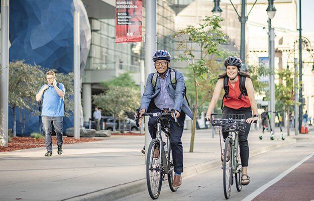
The best thing cities can do to incentivize bicycling is make it feel safer for people. This can be accomplished through interconnected networks of bike facilities separated from traffic that don’t end at major barriers.
That’s a big problem right now: we have a lot of bikeways that might get you part of the way to where you want to go, but then you get to a big intersection or an interchange with a highway and the bikeway ends.
We also need need to reduce motor vehicle speeds across the board, so that when bicyclists and motorists cross paths, it’s in a safe and controlled way. And we need to provide high-quality and secure places to park your bike once you get to where you’re going.
None of this is rocket science. If you look at countries that have successfully increased the percentage of people bicycling by even a few percentage points, it’s because they invested in infrastructure to make bicyclists feel safe — and, in fact, bicyclists are now safer in those places.
Drawdown also identifies e-bikes as a critical climate solution. While many bike-riders feel comfortable biking a few miles on flat surfaces, half of all trips are estimated to be 6.2 miles, which may be too far in the heat or if the route is hilly. E-bikes also better support riders who may be older or less able. What are some other ways cities and communities can incentivize e-bike use?
I am really excited about e-bikes because they eliminate another major disincentive to bicycling: hilly areas, with long, difficult uphill climbs. I live at the top of a really steep hill. Many times I have done that calculus in my head. Am I going to ride my bike? If I ride my bike, when I come home, I am going to have to come back up that hill.
When you look at a normal bike trip, it’s usually someplace between one to three miles in length. An e-bike trip is typically a little bit longer than a normal bike trip, because you don’t have to expend as much energy to make that trip.
The keys to incentivizing e-bike use are the exact same as they are for regular bikes. You’ve got to provide spaces where people feel safe riding their bike. E-bikes are a little bit faster than regular bikes, so that makes it even more evident that sidewalks are not the right place for them. E-bikes really need their own space. They need separated bike lanes. They need shared-use paths and bike boulevards. You have to feel like you have safe places to ride.
Cities are also providing e-bikes through their bike share services, which gives people a way to check them out and realize how much fun they are to ride. It’s one of the reasons why e-bike sales are just soaring all around the country.
According to the U.N. Environment Program (UNEP), researchers in the U.K. found that biking to work is associated with 45 percent lower risk of developing cancer and a 46 percent lower risk of cardiovascular disease, compared to commuting by car or public transit. UNEP also states: “daily exercise prolongs life expectancy by approximately 3.4 years. Regular cycling boosts physical health as an efficient way to prevent obesity.” How can we better promote the health benefits of biking to communities?
Those are some pretty incredible statistics I think that most people are not aware of.
It’s more about providing ways for people to introduce exercise into their normal, everyday life without even thinking about it. There are a lot of studies that show people are more active and healthy in places where walking and biking for everyday trips is common, so making sure that destinations in shopping areas and workplaces are in close proximity to home is really an important part of making sure that people take those everyday trips on foot and by bicycle.
We need to make bicycling the logical choice — the no-brainer choice — for a certain segment of short trips we make. When you go to The Netherlands and ask people why they are riding bikes, they almost never talk about the exercise or the environment. They are riding a bike, because it’s the most efficient way to get where they want to go.
Countries like The Netherlands have a lot of folks who bike well into their 70s and 80s, because they have provided places that feel safe for riding a bike. I have no doubt it contributes to a much longer lifespan.
Data also shows that the pandemic has resulted in a bike boom in many cities and communities. According to a report from Strava, a fitness tracking company, bike use in car-centric cities like Houston increased by 138 percent and in Los Angeles by 93 percent. The Rails to Trails Conservancy found that trail use increased threefold in March 2020 over 2019. Do you think bike use will continue to remain at high levels after we have all been vaccinated? What role do you think “slow streets” have played? And if the bike boom continues, will it result in greater investment in permanent bike infrastructure?
I think it will. Bike use will continue to remain at higher levels, because our travel patterns have been disrupted in ways that we’re only now just beginning to realize. There’s a whole segment of workers who will probably never go back to working in an office from 9:00 to 5:00 five days a week. The flexibility of being able to work from home will mean that our rush hour is going to look different in the future.
Why drag yourself out of bed to go and sit in the car for an hour longer than you really need to just to get to work at a certain time? A certain segment of workers are going to make that calculus and say, “I don’t need to go into the office to work. I can do it right here,” because they’ve been doing it for over a year, and it worked fine. Working from home is going to become much more accepted and prevalent and, with that change, people are going to continue to look for ways to use a bicycle for trips that originate from their homes.
Slow streets have really been great, because they gave people places to ride that feels safe. I’ve heard so many stories of slow street projects that had opposition in the beginning and now people are getting upset when cities remove their slow-street designation. From what we’re seeing, cities are looking for ways to have more permanent, connected networks of bike facilities, and that was starting well before COVID-19. It’s not something that was new; I just think COVID brought it home how much we needed more infrastructure.
Research also finds that low-income communities bike to work more often than other groups. The Chicago Tribune reports that the biggest group of Americans who bike to work are from households that earn less than $10,000. But a report from the League of American Bicyclists also found that Hispanic bike-riders had a bike fatality rate 23 percent higher, and Black riders had a fatality rate 30 percent higher than white riders. How can cities and communities make bike infrastructure more equitable and improve safety for historic marginalized and underserved communities?
We need to do a better job at providing better infrastructure in underserved areas of our cities. Often these are the same neighborhoods that have been impacted by highway construction, where we have widened roads so that suburban commuters can get to their jobs and downtown. It’s not a surprise those are the same places that have higher rates of crashes for Hispanic and Black riders. They need more attention than we’re giving them in terms of providing safer facilities.
A lot of the work we do for cities is about adjusting that balance and giving more attention to neighborhoods that have been neglected when it comes to providing good places to not only to bike but also to walk. Among other things, we aim to reduce traffic speeds on those streets, which is not an easy thing because they were built for higher speeds.
Many of the projects we work on are focused one equity. For example, we are working on an expansion of the trail network in Fresno, California. We analyzed all the proposed trails the city has planned to build in the next 20 years using a tool that prioritizes equity factors. The city then selected four connecting trails segments in a community facing environmental injustices. It relied on a tool used in California that helps identify communities most affected by pollution and where people are often especially vulnerable to pollution.
The Biden administration just released a $2 trillion infrastructure proposal, which could result in much greater investment in complete streets, bicycle networks, trails. If you were somehow in charge of all the billions, how would you allocate it on bicycle infrastructure?
In many communities, they have already tackled their easier projects, the ones that weren’t difficult to build — streets that were overbuilt for the amount of traffic they’re carrying and required a road diet to reconfigure space.
The next phase of work is much harder. It’s closing the gaps between facilities. Imagine a trail that ends at a major intersection. It’s hard to get across that intersection in order to connect one part of town to another part of town where you have bike networks. You really need an overpass across the highway built for bike and pedestrian traffic. If I were in charge of that infrastructure investment, I would make it available for major infrastructure projects that close gaps in bike and pedestrian networks.
In South Bend, Indiana, your staff partnered with the administration of then-Mayor Pete Buttigieg, who is now U.S. transportation secretary, to create an open space and smart streets plan to revitalize South Bend’s downtown. The plan resulted in the transformation of St. Joseph’s Boulevard to a green complete street. Secretary Buttigieg said the streetscape improvements led to $90 million in private investment by downtown businesses along the corridor. Can you tell us more about Secretary Buttigieg and his understanding of the connections between streetscape improvements and revitalization?
The most basic answer for how that revitalization led to all the private investment is that the design prioritizes the movement of people over cars. It was a very controversial approach to their downtown revitalization, and there were a lot of people who were worried that it wouldn’t work. To Secretary Buttigieg’s credit, he had a vision for making their downtown be a place where people felt comfortable walking everywhere.
The downtown businesses saw that it was going to be a place that was really special, which is what led to the investment. And it hasn’t stopped with downtown. The work we’re doing now in South Bend is going out like tendrils into the community. The city is systematically tackling their street network and prioritizing pedestrian and bicycle traffic. Secretary Buttigieg’s vision has continued to transform the city’s approach to transportation and it has clearly benefited the community.
Your firm is leading an interdisciplinary team working with the city of Atlanta’s Department of City Planning to re-imagine Peachtree Street as a shared space that blurs the lines between public space and streets. What are the benefits of these environments? How do you overcome safety or accessibility concerns?
Peachtree Street has long been Atlanta’s main street. The street receives a lot of traffic and is dominated by cars. The city is looking to change that dynamic and make it a destination for people. The benefit of making Peachtree Street a flush street — so all one level, no curbs — is that it really promotes that feeling that it’s a street where pedestrians are the highest priority. They don’t have to go to an intersection in order to cross the street. They can move freely across the street. It’s modeled on the types of streets that have been built really all over Europe, where there’s just one street surface.
Another benefit is that it slows everybody down. Cars can still travel down the street and park, but drivers don’t feel comfortable going fast down a flush street. Often there are fewer traffic signals or signs to direct traffic. This is due to a concept in traffic engineering: when you introduce an element of uncertainty, everyone slows down. It’s fundamentally about making sure motor vehicle traffic goes slower.
Also, a flush street is inherently more accessible. You can imagine people on wheelchairs don’t have to go to the corners to find a place to cross. People pushing baby strollers can easily move about. But you do need special accommodations for people who are blind or have low vision, because they need to know how to navigate down that street. They often use a curb line as a guide.
Fortunately, there are new ways to help people who are blind to navigate. A different type of pavement treatment with raised grooves can help guide a person with a cane down a street. These have been used in train stations and other places where there is a need to navigate through plazas and other open areas.
Landscape architects integrate safe, accessible pedestrian and bicycle infrastructure with green infrastructure. In St. Paul, Minnesota, your firm designed the Jackson Street Reconstruction Project, which transformed an outdated avenue into a truly multi-modal corridor that features two-way protected bike lanes, wider pedestrian walkways protected by green buffers that manage storm water. How is this project a model? How do you make the case that communities should spend the extra money for the green infrastructure?
Jackson Street is just such a great example of the way we should be designing streets in this country.
It’s important to think about what the street looked like before to understand the opportunity it represents for many other streets in this country. Jackson Street was as wide as six lanes, a classic example of an overbuilt street. Somebody at some point in the past decided that the road needed to have four lanes. The street didn’t have the traffic volume to support those lanes.
We were able to take up to two travel lanes off the road, which gave us 20-plus more feet of space to work with to provide a wider sidewalk, a two-way separated bike lane, and generous rain gardens between the bikeway and the road. We were able to use the green infrastructure to provide that much needed separation between the bikeway and the street. The bikeway itself is built from pervious pavement. The runoff from Jackson Street is directed into those rain gardens.
St. Paul is a city concerned about water pollution, runoff, and flooding. It’s on the banks of the Mississippi, so this type of street design is logical. There are so many cities around the country that are increasingly concerned about flooding and need to find ways to let stormwater seep into the ground instead of run off into nearby waterways. Cities are feeling the impact of major flood events and the financial cost of those events, which is why they are looking at these streetscape projects as an opportunity to rethink the way that water flows in their city.
There are generations of work for landscape architects to fix all these streets and make them greener by providing vegetation in the streetscape on a scale that we’ve never done before. We were sort of stuck in the past with these tiny tree boxes. That was the conventional way of providing green in the landscape. This new way of designing streets is going to give us so much more room to work with different types of plants and soils. It’s a really exciting time to be a landscape architect.